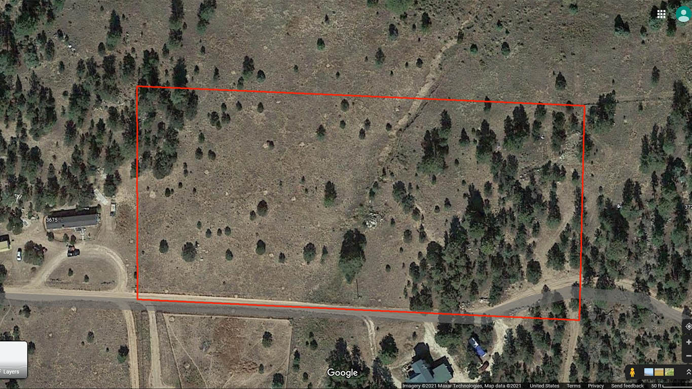
Florida-Colorado Acres Tr-175, Cotopaxi, CO 81223
Lot Information:
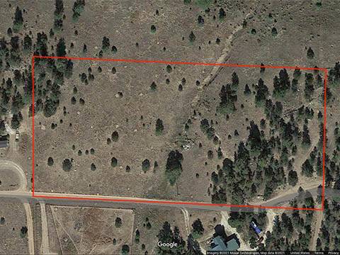
Legal Description: Florida-Colorado Acres Tract 175, S2, SE4, SE4, SE4, Sec 18, T20S, R72W, Fremont County, Colorado
5.05 acres Total Lot Acreage,
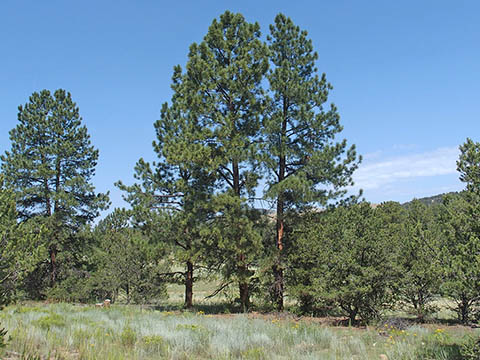
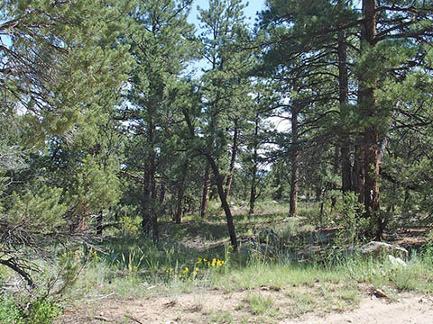
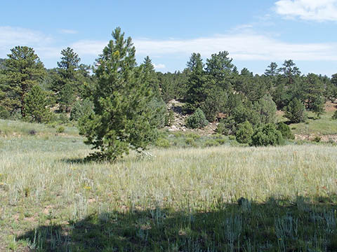
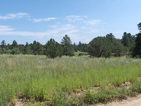
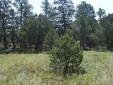
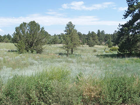
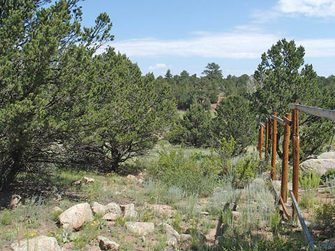
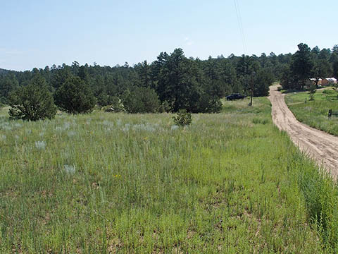
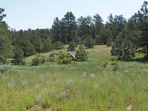
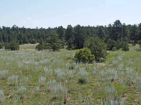
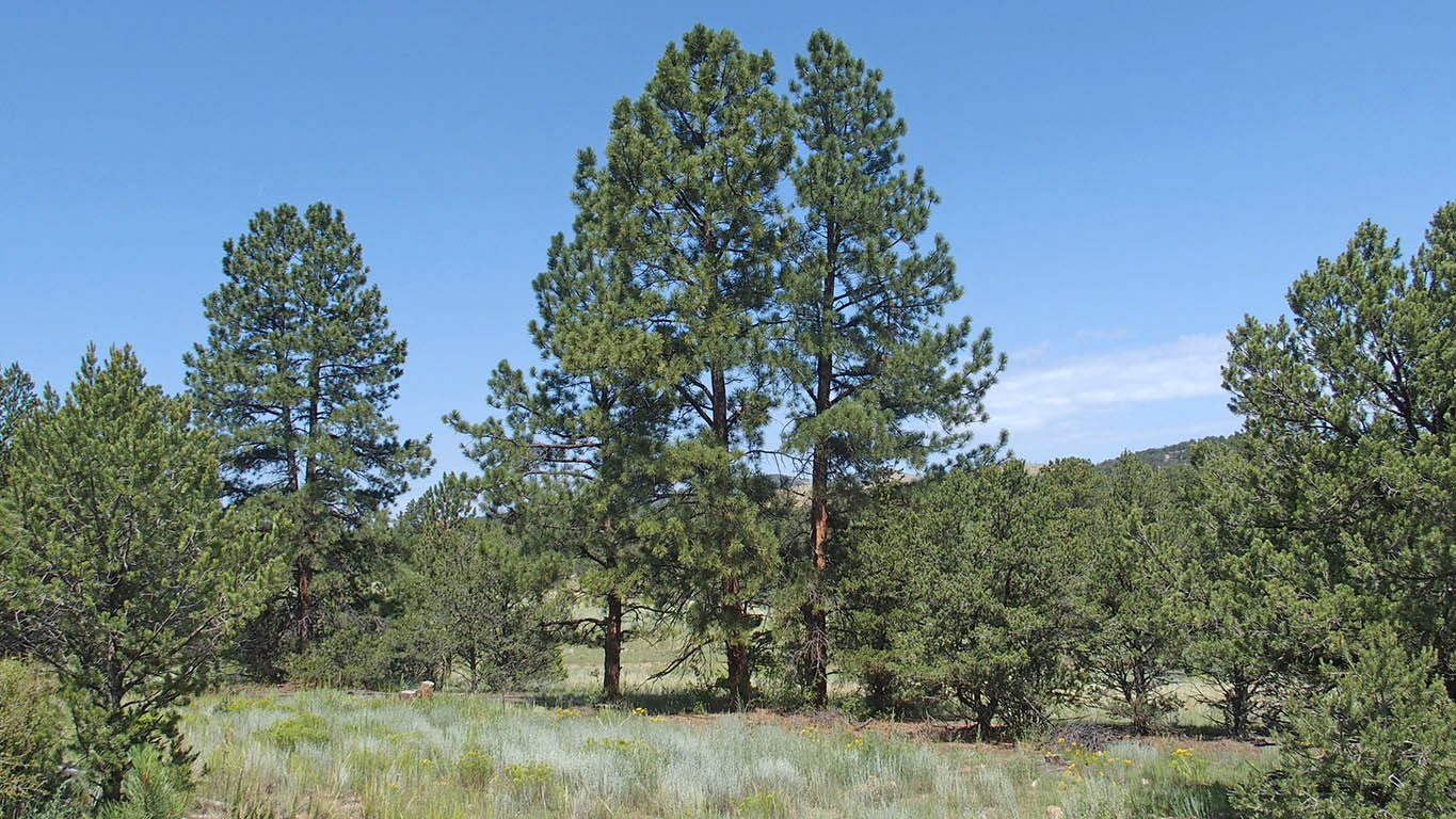
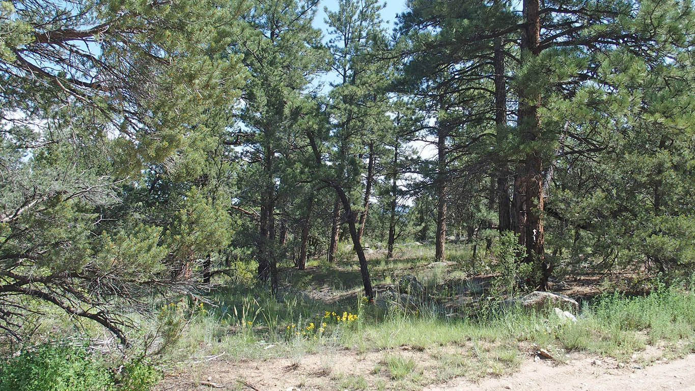
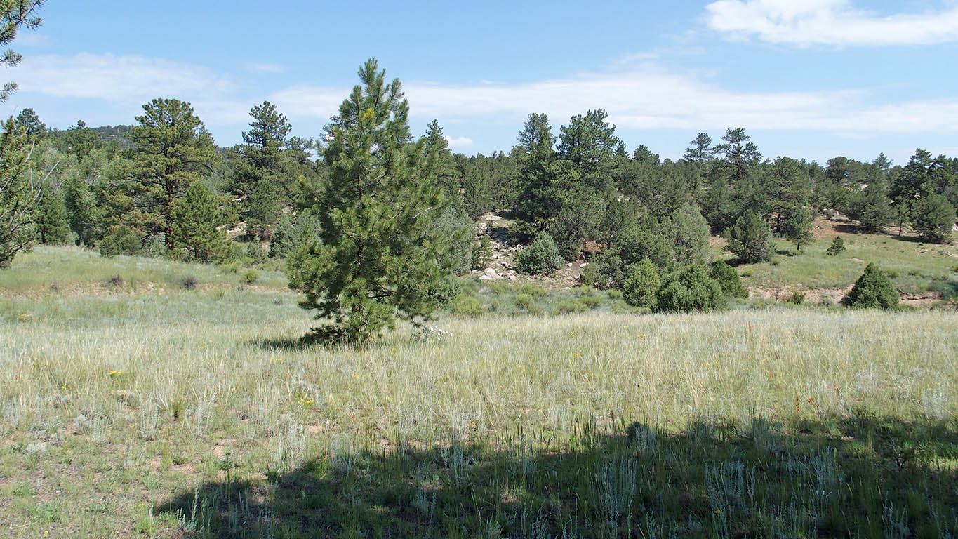
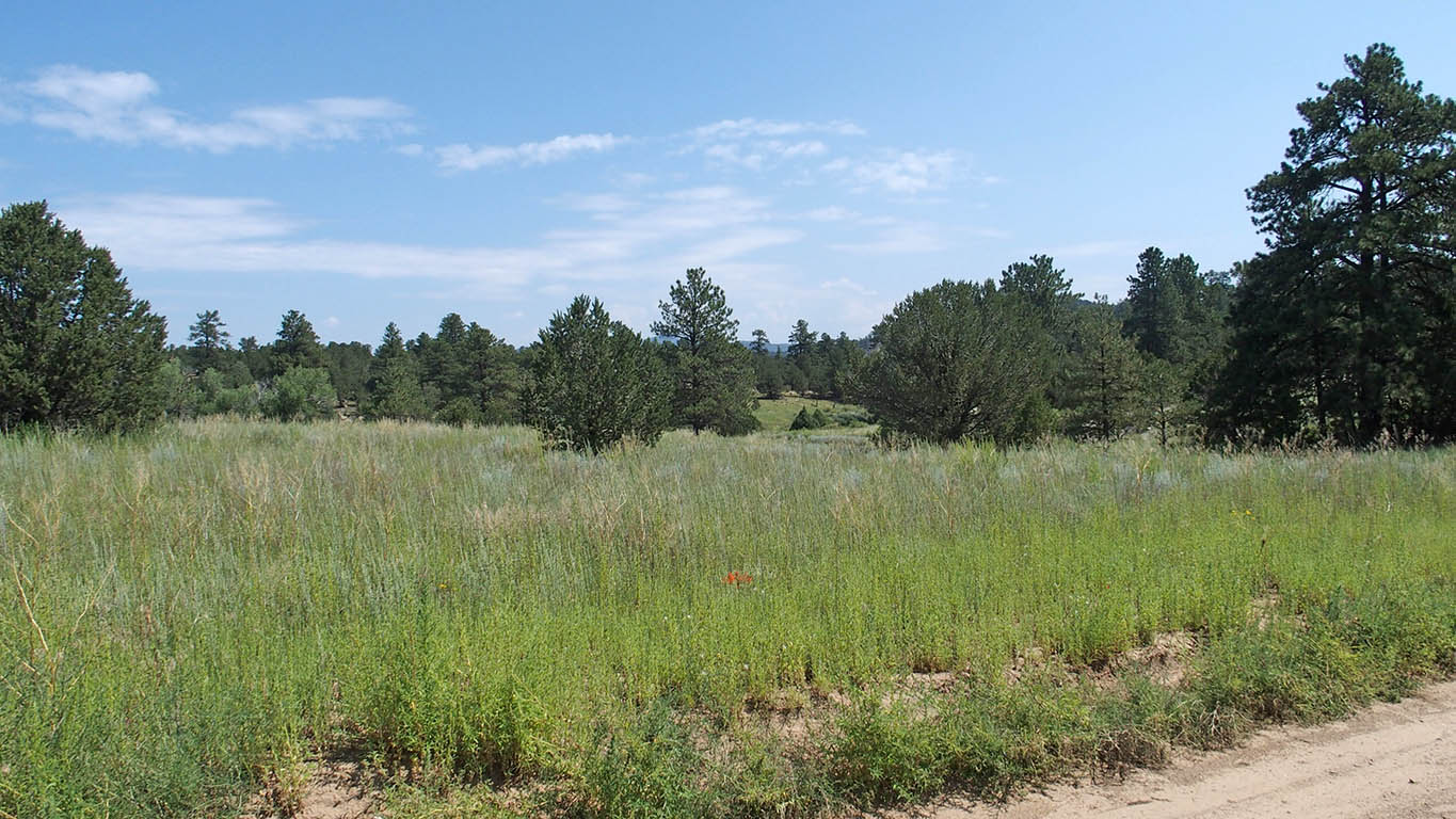
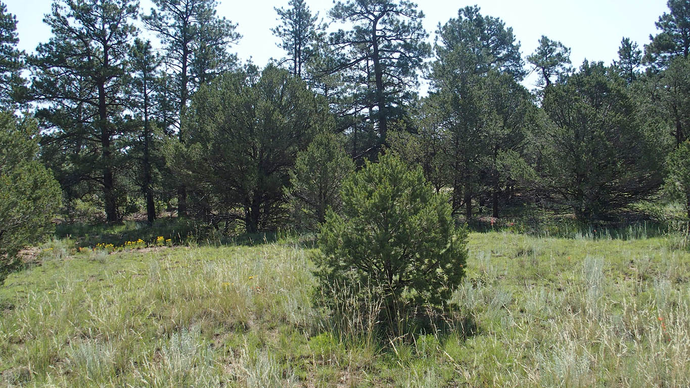
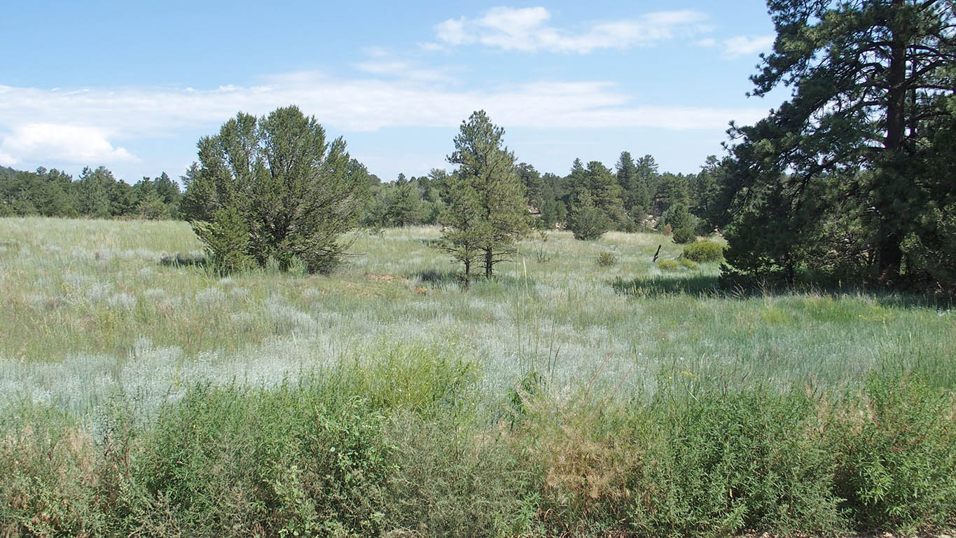
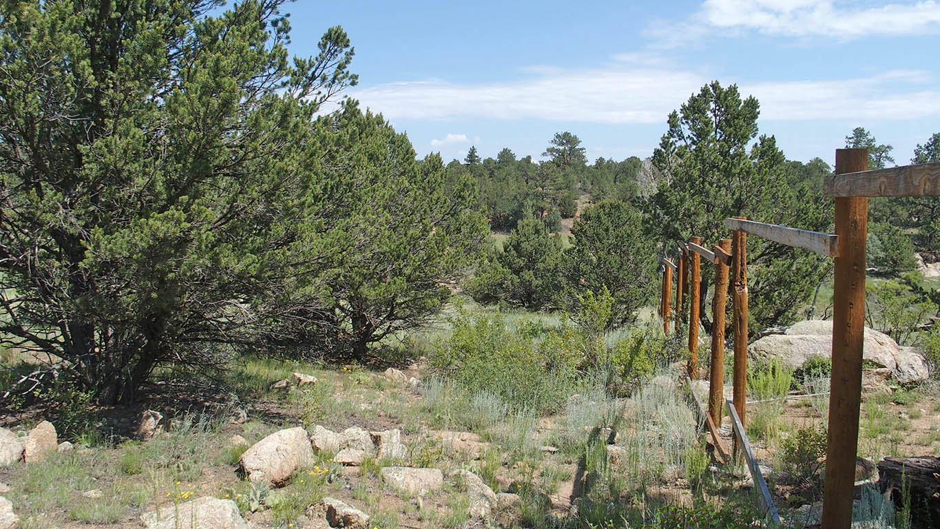
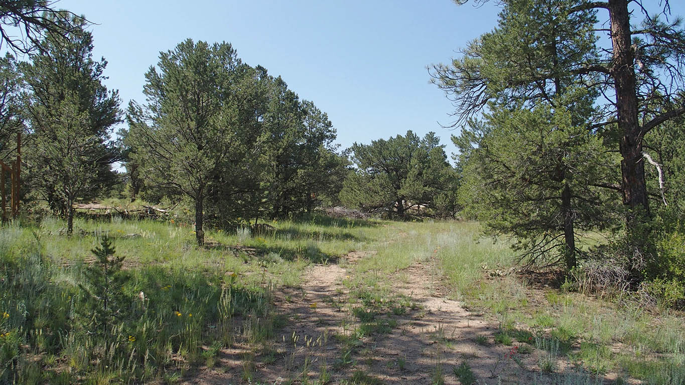
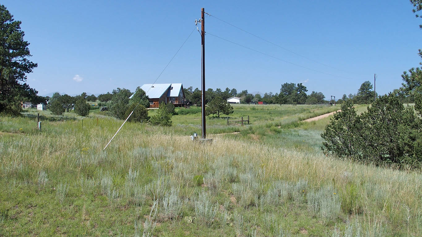
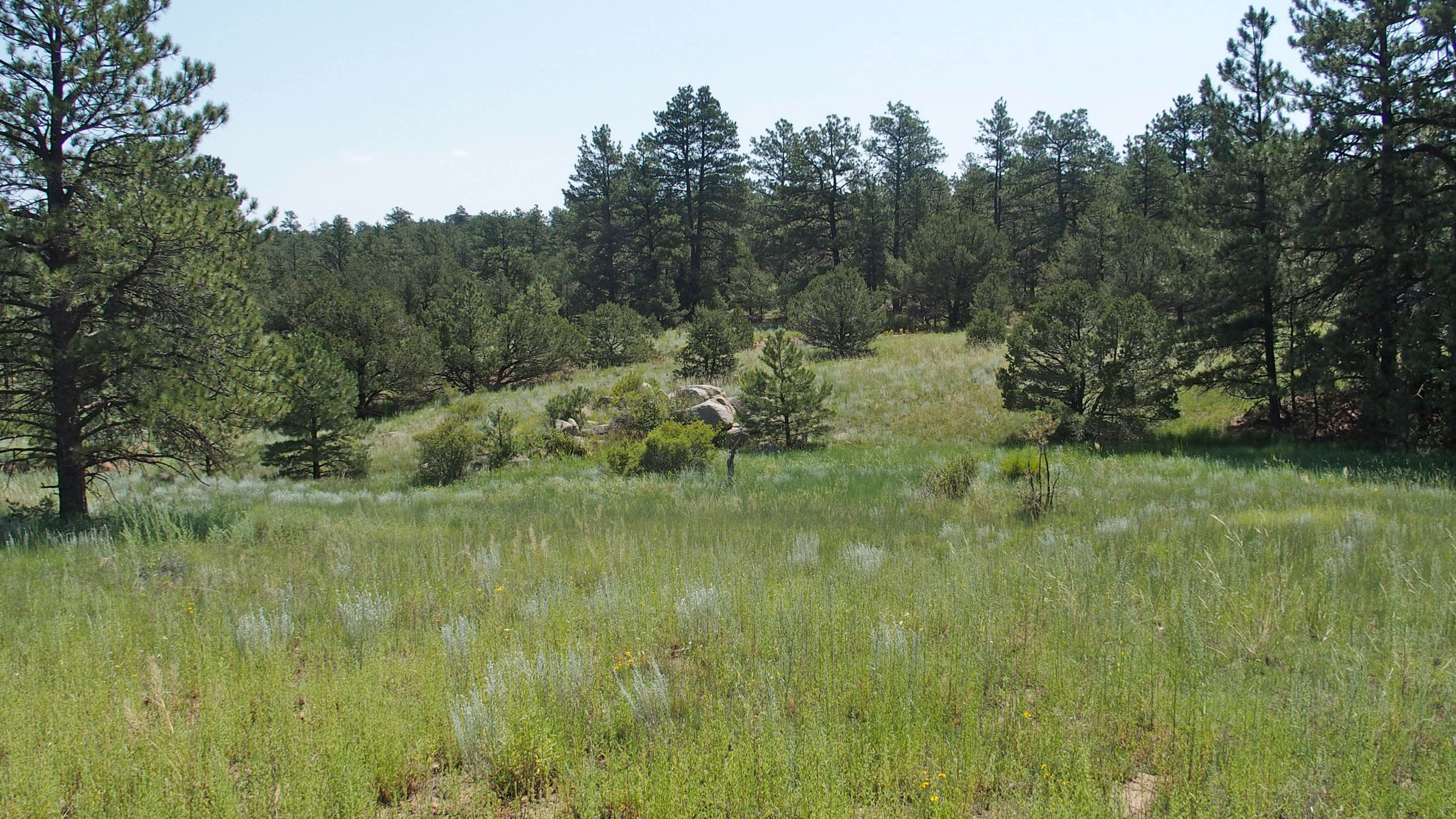
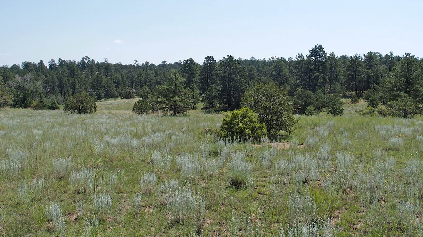
Nicely treed property, tall conifers,
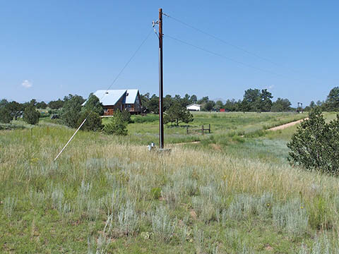
Electric at property line. Two available transformers.
Four good wells within 300 ft (200 to 405 ft depth, 2 to 14 GPM).
Additional three good wells within 700 ft, (200 to 250 ft depth, 2 to 8 GPM)
Mobile homes allowed,
Zoning AE - Agricultural Estates Zone - minimal restrictions
Camping friendly community, Long term RVs noted on several properties,
NO POA/HOA,
Fire station in area - lower home insurance
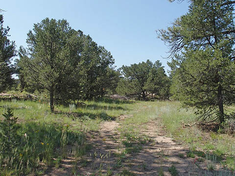
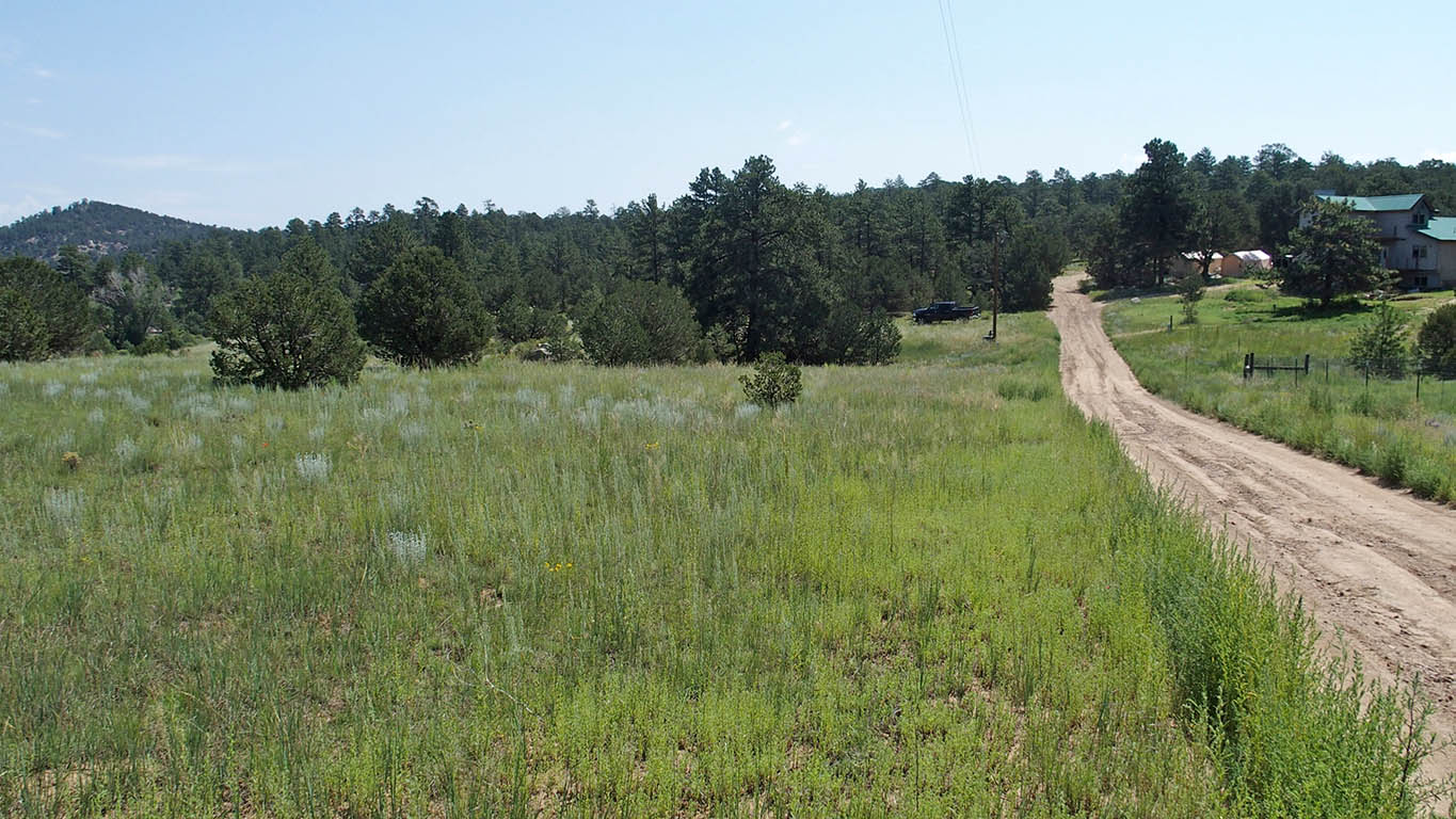
Road to property rough but passible by normal ground clearance car or RV,
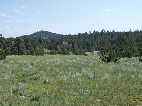
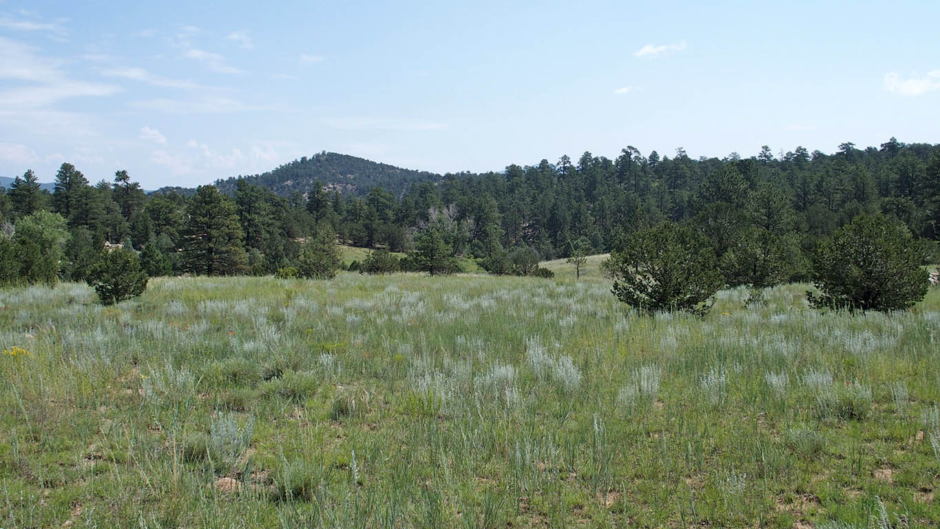
Gorgeous mountain views,
Very buildable, many great building sites,
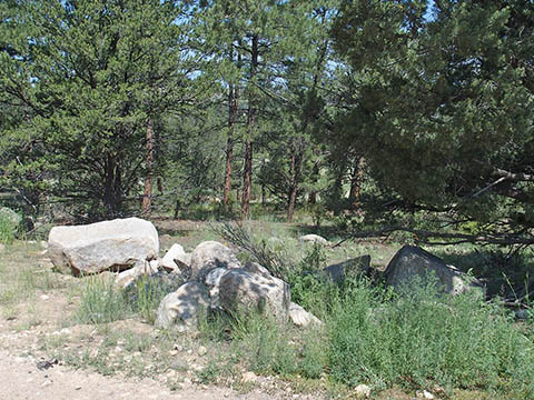
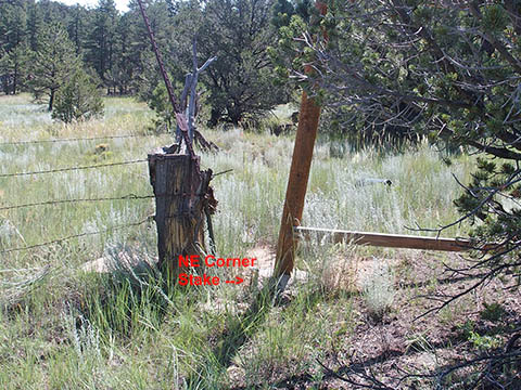
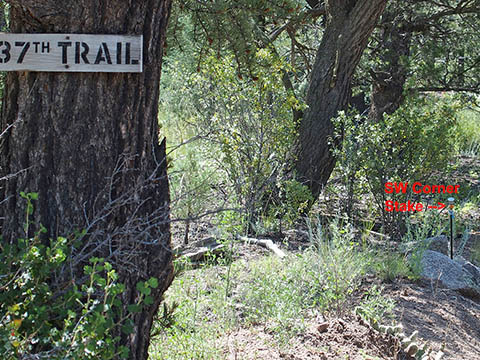
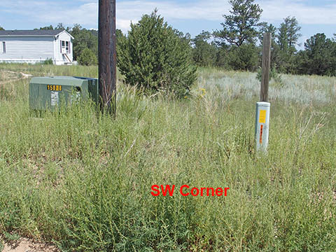
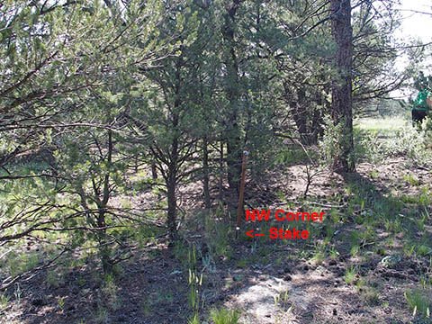
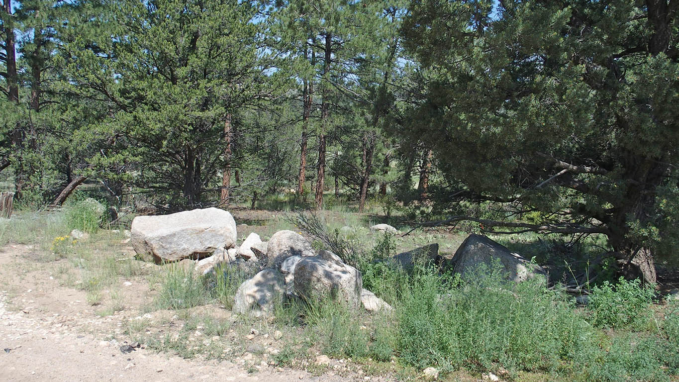
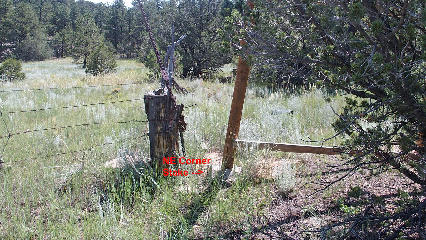
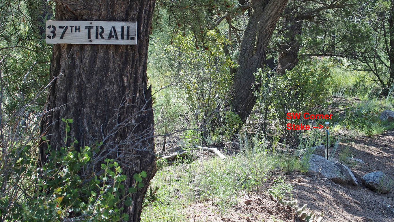
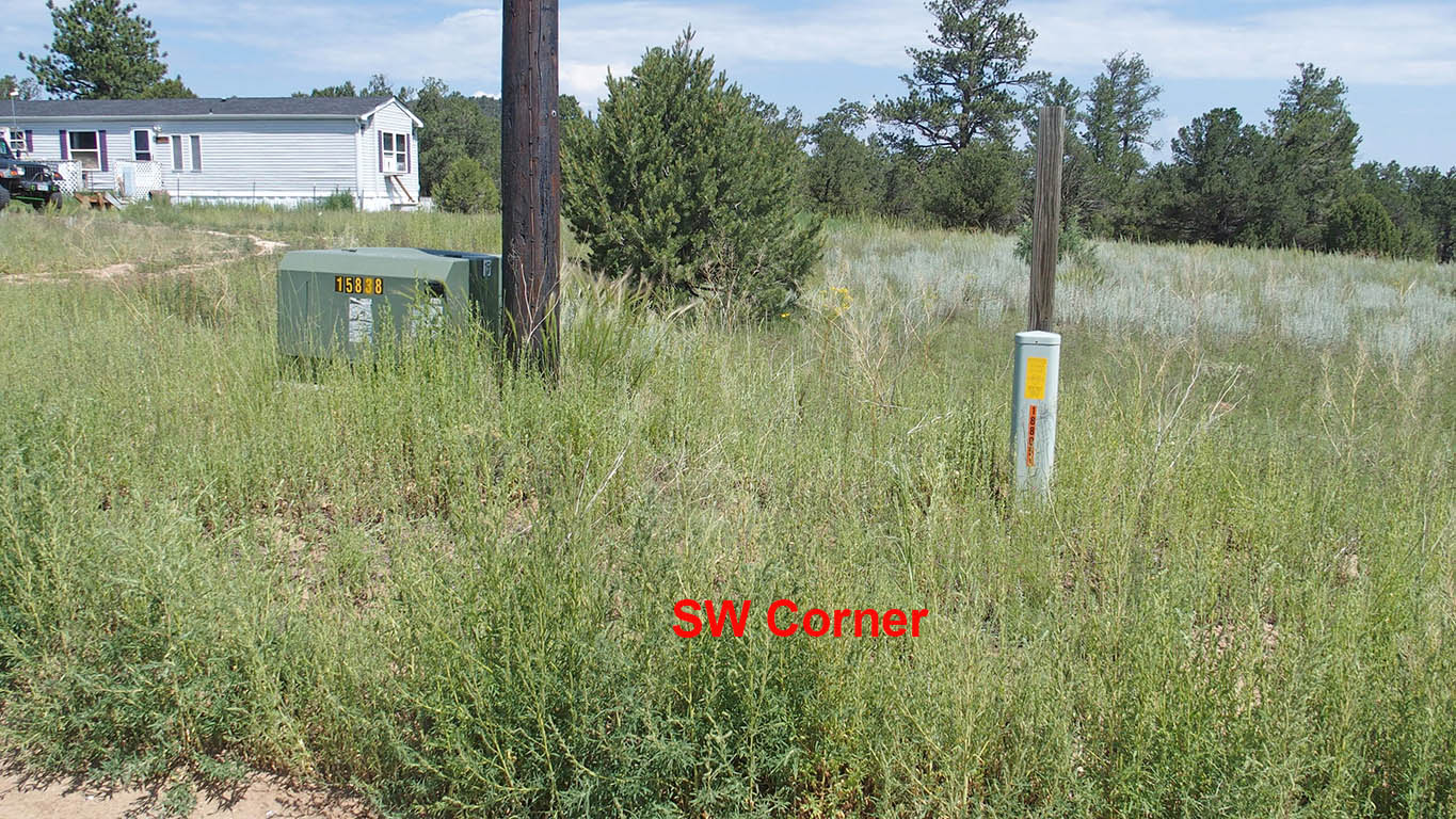
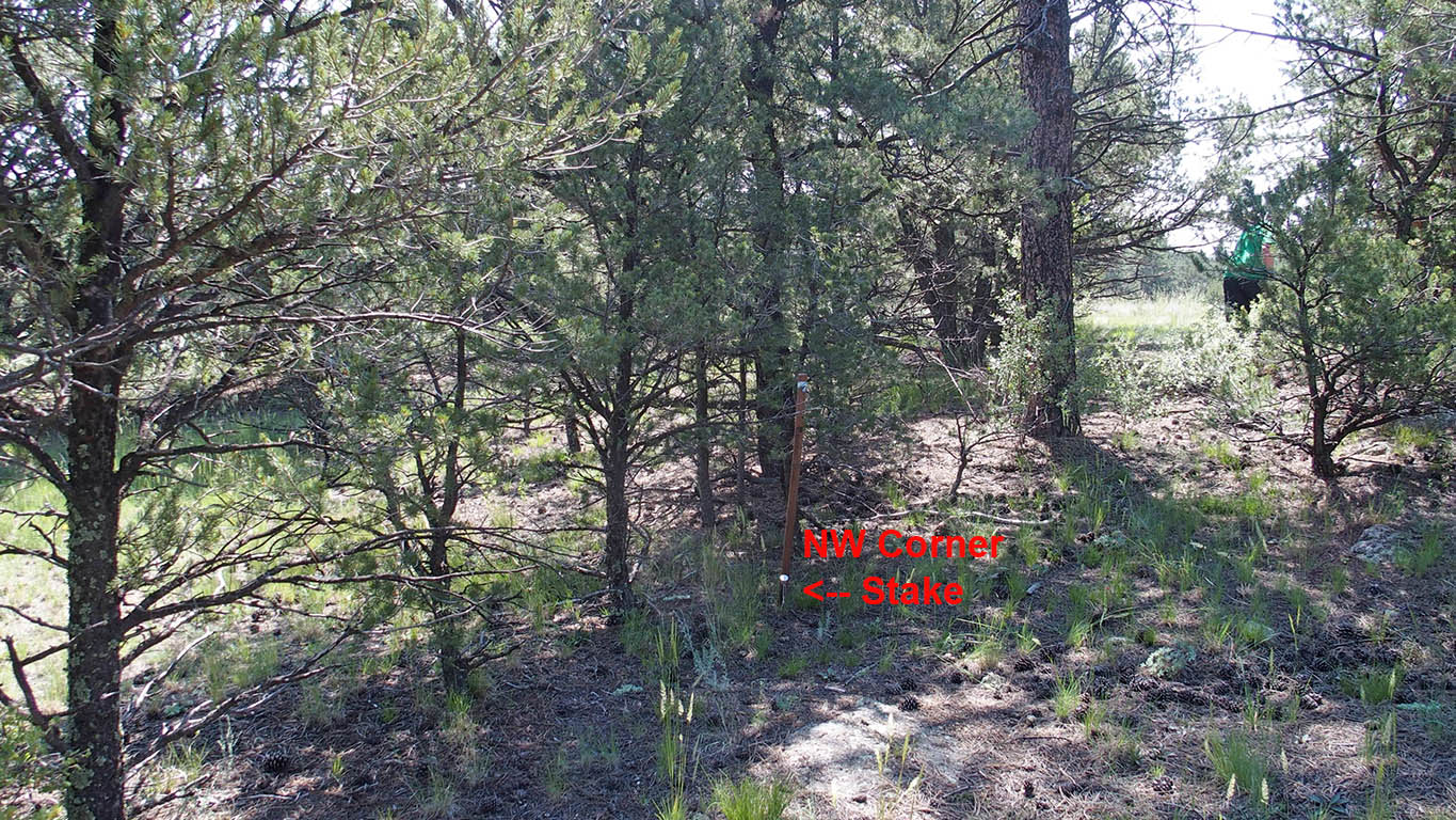
3 Corners staked - pictures shown below.
Discounted cash price: $34,999. Financed price only $41,999 ($4200 down)
Please note, if financing from us, see below for camping restrictions*
Cabins, Tiny homes, mobiles - Minimum dwelling sizes
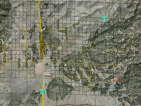
Click here for Google Maps showing aerial view of property. Map can be zoomed and scrolled for additional information.
Click here for Bing Maps. Map can be zoomed and scrolled for additional information.
Actual Property Pictures, taken July 25, 2021 (Click on images to enlarge).
|
|
||||
|
|
||||
|
|
||||
|
|
||||
|
|
||||
|
|
||||
|
|
||||
|
|
||||
|
|
||||
|
|
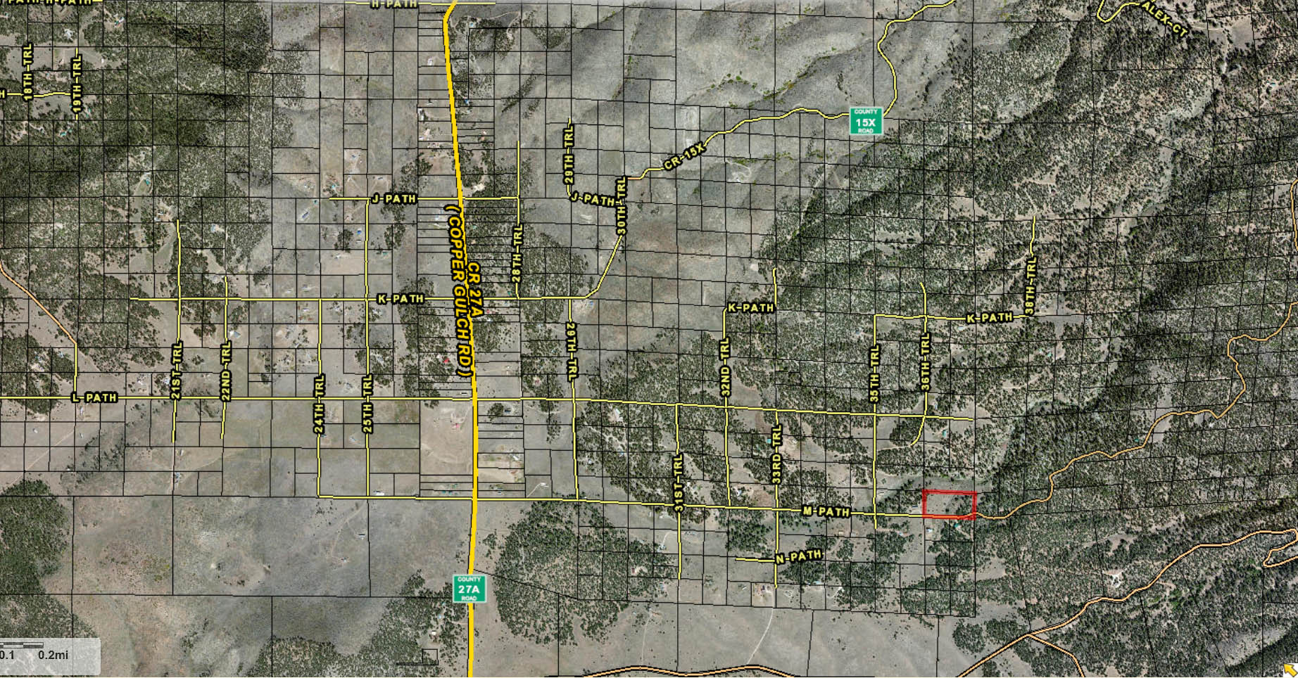
Directions: (Using "latitude longitude" We were able to use the Maps app on our iPhone to navigate to the property) - type in: 38.30624, -105.46439 Alternate Maps address: House to left (west)of our property has address of 3675 M Path Cotopaxi. Remember, L Path rd is MUCH smoother
From Guffy, CO:
1. Depart US-50/CR-3 (Copper Gulch)
2. Turn South from US-50 onto CR-3, (1.7 mi)
3. At the Y, bear right onto Copper Gulch Rd, continue on Copper Gulch Rd (eventually becomes a dirt road). (13.9 mi)
4. Turn left onto M Path (Bear Run). You will see the road designations (Path letters) ascend as you near M Path (M Path is a bumpy road). Property is 1.2 mi from this turn off. - ALTERNATIVE: L Path is much better maintained, Take it down to 35 Trl, turn right, than left on M Path. Property starts 660 feet after turn, on the left (see no. 5. next).
5. Property is on the left. The last electric pole is near the middle of the front boundary. Use of GPS coordinates is recommended to confirm location.
* For those persons opting to use owner financing, until the property is completely paid off and deed recorded, we do not allow building projects, living on the land, or storing of equipment, supplies, or vehicles. We do allow short-term camping. All county Rules and Regulations must be followed regarding camping and permitting. If you get our permission, you can put in a driveway and/or camping pad.